
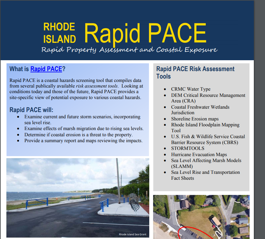
Rapid Property Assessment and Coastal Exposure (Rapid PACE)
Preparedness and Decision Making for Coastal Properties in Rhode Island
 More frequent intense storms and increasing sea levels require proactive planning and action for our communities to become more resilient. The Rapid PACE interactive map is an easy-to-use tool for identifying coastal flooding risk and possible impacts on your property and your community. Municipal officials, businesses and citizens can look at individual properties to get a snapshot of areas exposed to storms, erosion, and sea level rise; evacuation zones, salt marsh migration areas as well as different management jurisdictions. For further explanation check out the Rapid PACE Fact Sheet. The Rapid PACE uses existing, publicly available sources of data.
Municipal officials may request a Rapid PACE Assessment for a site-specific property to inform planning initiatives or regulatory decisions, and enhance efforts that support safer, more resilient communities. An example site report explains the additional information gained from the completion of a Rapid PACE Assessment.
The Rapid PACE Assessment Report for Municipal Officials will:
- Be completed by URI typically within 48-hours of a request

- Compiles existing information
- Examine current and future storm scenarios, incorporating sea level rise
- Examine affects of marsh migration due to rising sea level
- Determine if coastal erosion is a threat to the property
- Provide a summary report and maps reviewing the impacts
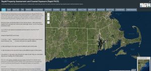
Rapid PACE Story Map
The general public can use this online interactive map to assess their property.
Rapid PACE Story Map Data Sources document
Rapid PACE Fact Sheet
Download Rapid PACE Example Report
Download Template for Rapid PACE Site Report
Tools Used in the Rapid PACE
Stormtools, is a set of web-based, interactive maps used for planning purposes to show the extent and water depth of inundation from 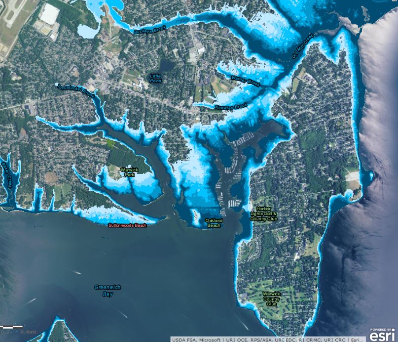 different storm surge and sea level rise scenarios.
The Rhode Island Floodplain mapper, provides the user with an approximate flood zone determination relative to a flood hazard 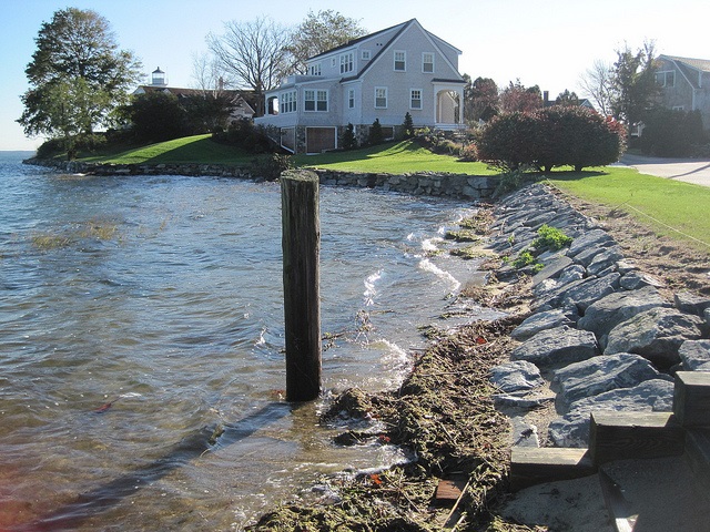 area. FEMA’s National Flood Insurance Program designations are used for regulatory purposes and are available on the FEMA Map Service Center.
Shoreli ne Change Maps display erosion trends which can be drastic over time or after severe storms. Used to determine regulatory coastal setbacks.determining the feasibility of developing shorelines.
Sea Level Affecting Marsh Models (SLAMM) maps display how wetlands ar e projected to migrate inland due to sea level rise. These planning tools can assist in determining buffer zones, areas to limit development, or to inform acquisition priorities with rising seas.

Sea Level Rise and Transportation Fact Sheets highlight vulnerable infrastructure assets by municipality. Impacts on Transportation Assets maps vulnerable state and local roads and bridges. Both are for planning purposes only.
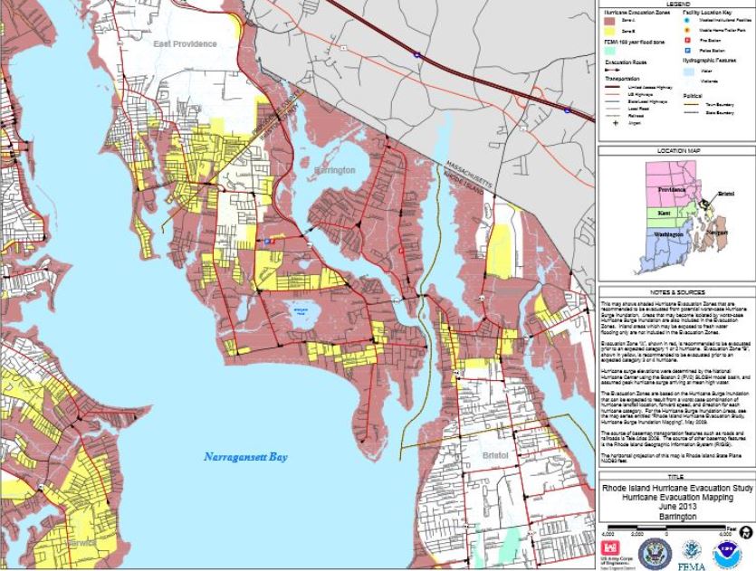 Flood Evacuation Maps, for planning purposes only, show Hurricane Evacuation Zones recommended for evacuation during potential worst-case Hurricane Surge Inundation.
Resources to Help Reduce Your Risk
The Rhode Island Emergency Management Agency’s Hazard Mitigation program works with municipalities to reduce risk from natural hazards. Efforts include flood mitigation assistance, pre-disaster mitigation, and the Hazard Mitigation Grant Program.
Click here to view RIEMA resources!
Training Resources
This website serves as the State of Rhode Island’s resources on climate change and resiliency. It houses resources for a variety of audiences including RI citizens, State agencies, municipalities, non-profit organizations, and the business community.